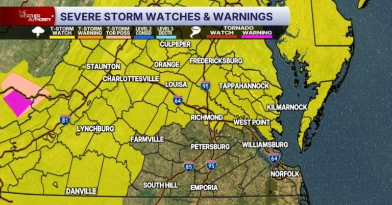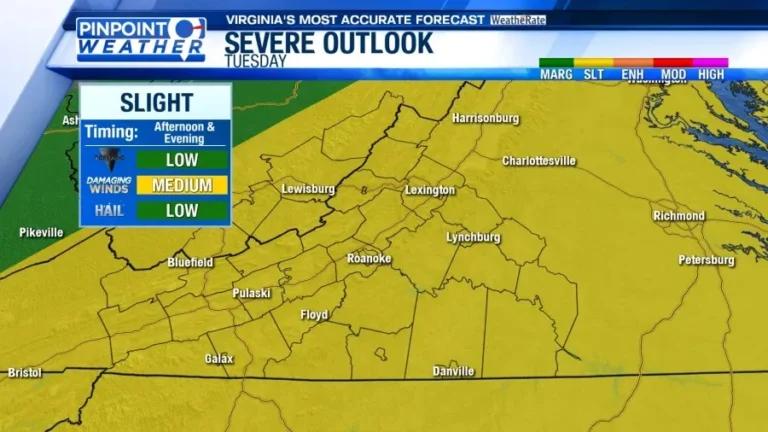


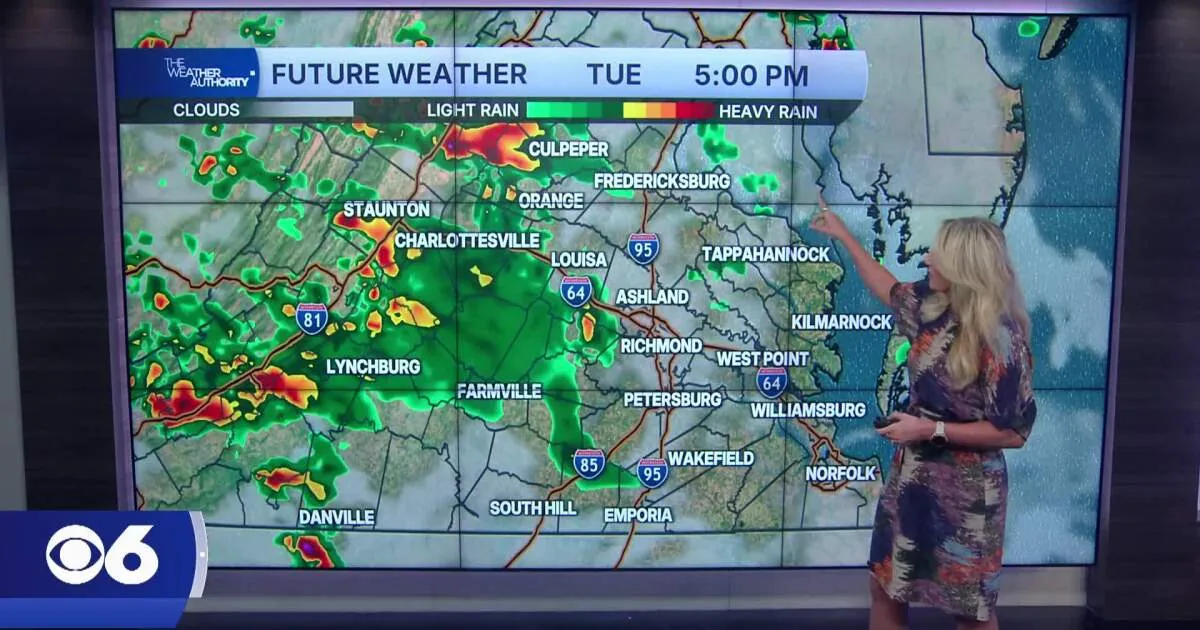
RICHMOND, VA — Widespread showers and thunderstorms are expected to move across Central Virginia Tuesday afternoon and evening as a strong cold front pushes through the region. Forecasters say the area faces a slight risk, or Level 2 out of 5, for severe weather. The main concern is damaging wind gusts, though large hail and a couple of brief tornadoes cannot be ruled out. Storms are expected to arrive quickly and move from northwest to southeast.
Storm Timing And Hazards
The most active period is expected to fall between 3 p.m. and 8 p.m. for much of Central Virginia. Temperatures should rise into the upper 80s on Tuesday, and the humidity will help fuel stronger storm development. While the exact timing can vary by location, the setup points to a fast-moving line of storms rather than a long-lasting event. Because of the storm motion, conditions could change rapidly once thunderstorms begin.
Officials also say localized flash flooding cannot be ruled out, especially in urban locations and areas with poor drainage. That means some roads could temporarily flood if heavy rain falls in a short period of time. Even outside the strongest storms, the combination of heat, humidity, and unstable air will make Tuesday feel unsettled through the evening hours.
Midweek Pattern Changes
Conditions are expected to improve on Wednesday as the front moves away from the area. Forecasters say the day will bring a fair amount of sunshine, although isolated showers or storms are still possible, mainly north of Richmond. Humidity should begin to ease slightly behind the front, giving the region a more comfortable feel than Tuesday.
The change will not be dramatic everywhere at once, but the overall trend should be toward calmer weather. Any leftover showers on Wednesday are expected to be scattered rather than widespread. That makes midweek a transition period from the more active storm setup on Tuesday to a quieter stretch later in the week.
Late Week Outlook
Thursday and Friday are forecast to be mainly dry, with slightly below-average temperatures and lower humidity. Highs should generally stay in the low to mid 80s, offering a break from the more oppressive air expected early in the week. Those days look to be among the calmer parts of the forecast and should provide a more settled pattern for outdoor plans.
By the weekend, warmer and more humid summer air is expected to return to the region. That change could bring a few scattered thunderstorms late Saturday into Sunday. Additional storm chances may continue into next Monday, suggesting the quieter stretch later in the week may be temporary.
Weather Tools Available
Residents are being directed to follow weather alerts, closings and delays, an interactive radar, and a map center for updates as conditions change. The forecast also references the CBS 6 Weather App for iPhone and Android. With storms expected to move quickly and some hazards possible, forecasters are urging people to stay alert through Tuesday evening and monitor the latest information before traveling or planning outdoor activities.