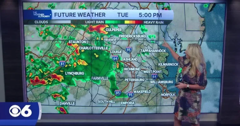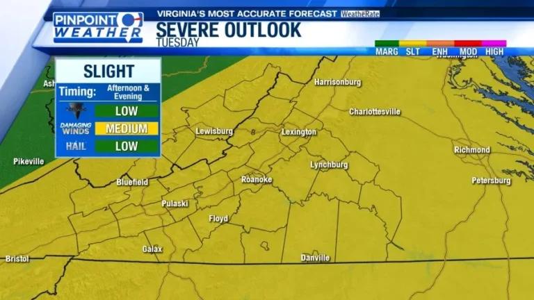


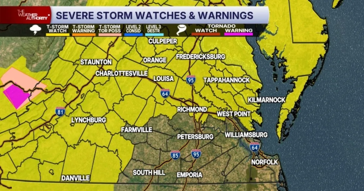
RICHMOND, VA — Widespread showers and thunderstorms are expected across Central Virginia Tuesday afternoon and evening as a strong cold front moves through the region. Forecasters say the area faces a slight risk of severe weather, with damaging wind gusts the main concern. Large hail and a couple of brief tornadoes are also possible. A Severe Thunderstorm Watch is in effect for the counties in the watch area until 10 p.m., with storms expected to move quickly from northwest to southeast.
Storm Timing And Threats
The most likely window for storms is generally between 3 and 8 p.m. across much of Central Virginia. Temperatures are expected to reach the upper 80s Tuesday, and the humid air will help fuel stronger storms as the front arrives. The weather setup raises the chance for intense downpours and fast-moving storms. While damaging winds are the primary threat, hail and a brief tornado cannot be ruled out in the stronger cells.
Flash Flooding Concerns
In addition to wind and hail, localized flash flooding is possible in urban areas and places with poor drainage. The storms are expected to develop and move through quickly, but heavy rain could still lead to water collecting in low-lying spots and trouble on streets that do not drain well. The forecast does not call for widespread flooding, but officials are warning that the most vulnerable locations could see short-term impacts during the afternoon and evening storm period.
Midweek Weather Outlook
Conditions should improve on Wednesday, when sunshine is expected for much of the day. Forecasters say isolated showers or storms could still develop, mainly north of Richmond, but the overall pattern turns less humid behind the front. That cooler, drier air should continue into Thursday and Friday, which are expected to stay mostly dry. Highs are likely to hold in the low to mid 80s, a bit below average for late July.
Weekend Storm Chances
By the weekend, summer heat and humidity are expected to return to the region. That warmer air could bring another round of scattered thunderstorms late Saturday into Sunday. Additional storm chances are also possible into next Monday, keeping the forecast unsettled as the new week begins. Residents are being advised to keep an eye on updated weather information as the front moves through and the pattern changes again later in the week.