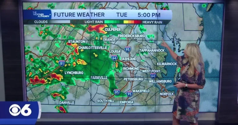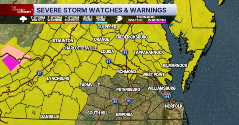


ROANOKE, VA — Scattered showers and thunderstorms are expected Tuesday across Southwest and Central Virginia as a cold front approaches the area, and some storms may become strong to severe. Forecasters said the first round is likely to arrive from the northwest during the morning, with the potential for strong wind gusts and heavy rain. Because instability will be limited early in the day, severe weather is less likely in the morning, but localized flooding could develop in poor-drainage and urban areas. A second round is expected later in the day.
Afternoon Storm Threat
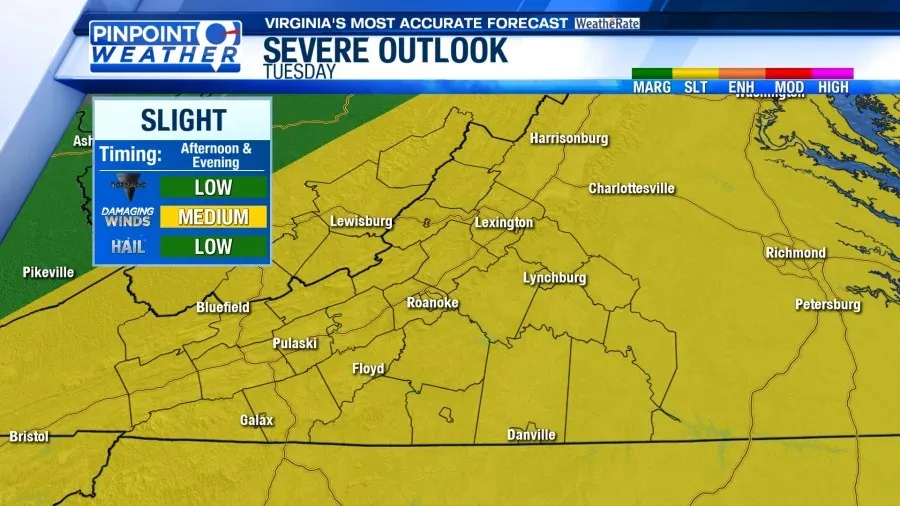
The more significant risk may develop during the afternoon and early evening as the cold front moves through and skies briefly partially clear. That clearing could allow instability to increase, making severe storm development more likely. Damaging wind gusts are expected to be the main severe threat, while hail and isolated tornadoes are considered secondary risks. The timing of that second wave is important because it could overlap with the warmest part of the day, when storms can strengthen more quickly. Rain should taper off before midnight.
Rainfall And Flooding
Even where storms do not reach severe levels, downpours could still cause problems. The forecast calls for heavy rainfall in some of the stronger cells, and that raises the chance of short-lived flooding in low-lying spots. Poor-drainage areas and parts of cities are especially vulnerable when showers come in bursts. Officials and residents typically watch these conditions closely because repeated rounds of storms can quickly overwhelm storm drains. Winds are also expected to increase as the front passes through the region.
Temperatures Across The Region
Tuesday’s highs will vary by location, with upper 70s and lower 80s expected in the New River Valley and Highlands. The Roanoke Valley, Central Virginia and Southside should be warmer, with mid- to upper-80s likely. Those temperature differences reflect the varied terrain and the timing of the front moving through the area. After the storms move out, Southwest and Central Virginia are expected to get a brief break from the daily rain chances. Wednesday may still bring a few spotty showers, but most of the rainfall should be finished by nightfall Tuesday.
Midweek Forecast Outlook
From Wednesday through Friday, the weather pattern is expected to improve with mostly to partly sunny skies across the region. High temperatures should remain in the upper 70s and 80s during that stretch. Forecasters described the period as a short pause from the recent run of daily rain chances, although the air will still be warm enough for typical summer conditions. The main focus for Tuesday remains the possibility of strong thunderstorms, especially later in the day, before calmer weather returns for the second half of the week.